Some mountains stay in your memory primarily because of their views, while others hide an entire story behind their beautiful panoramas. Our hike to Wildspitz was exactly that kind of experience. At 1,580 meters, Wildspitz is the highest point of the Rossberg ridge and also the highest point in the Canton of Zug. From here, a magnificent panorama of Central Switzerland opens up: lakes, green hills, distant Alpine peaks, and familiar towns far below suddenly seem incredibly small. But what impressed us most was the neighboring summit of Gnipen. Standing there today, surrounded by silence and extraordinary beauty, it is difficult to imagine that more than two hundred years ago, one of the most devastating natural disasters in Swiss history began right here.
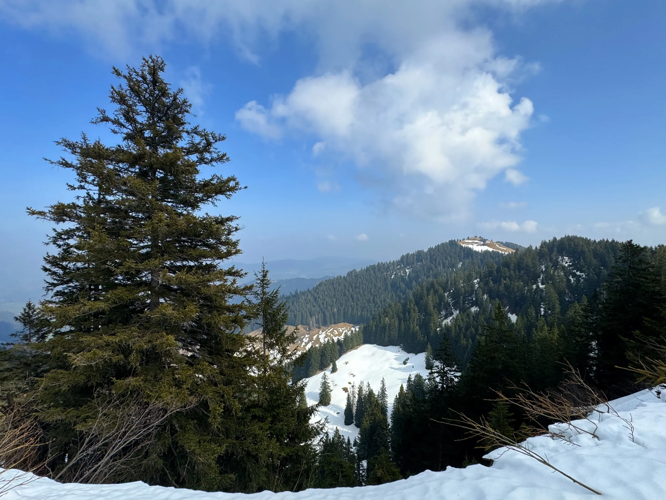
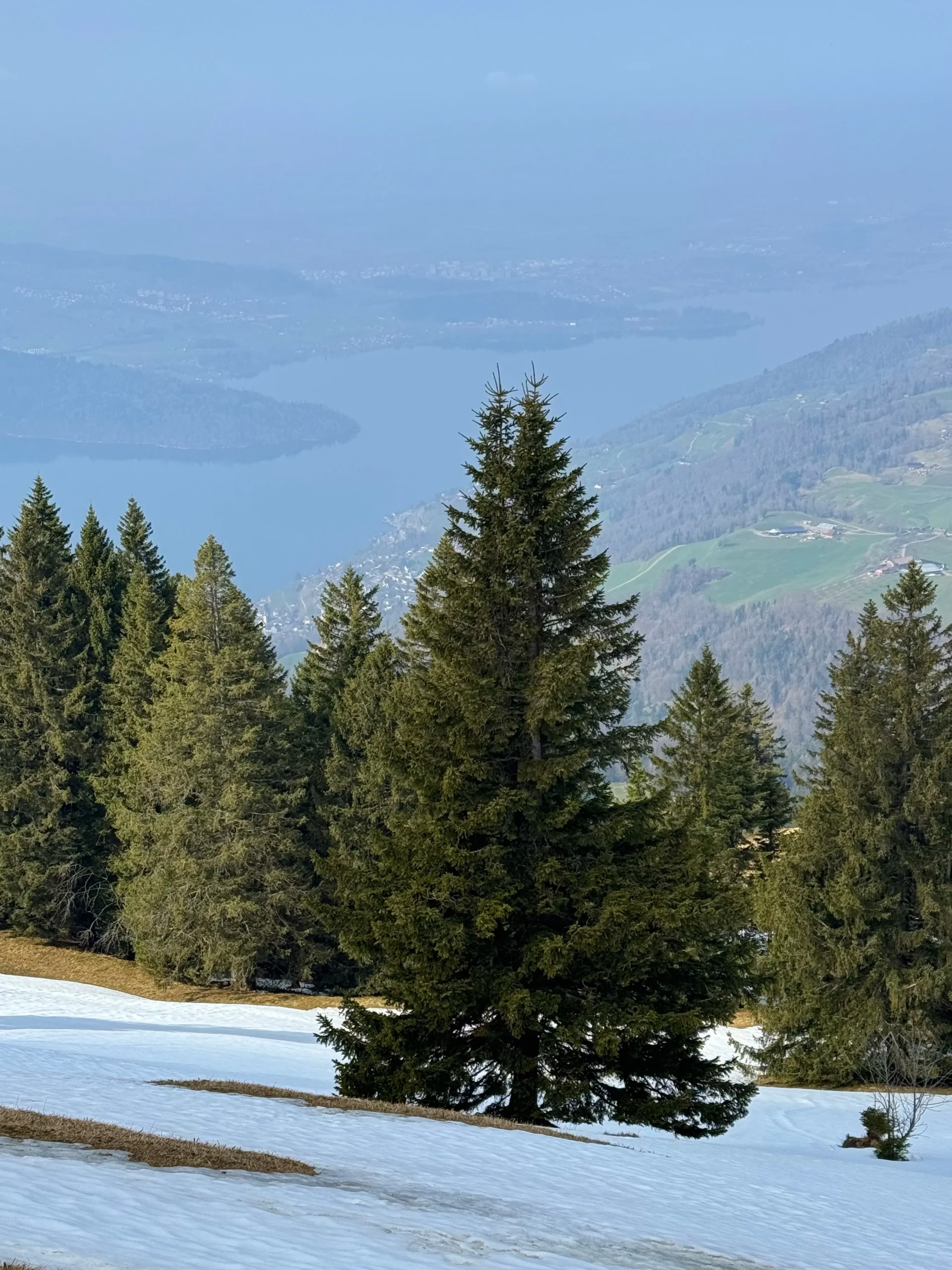
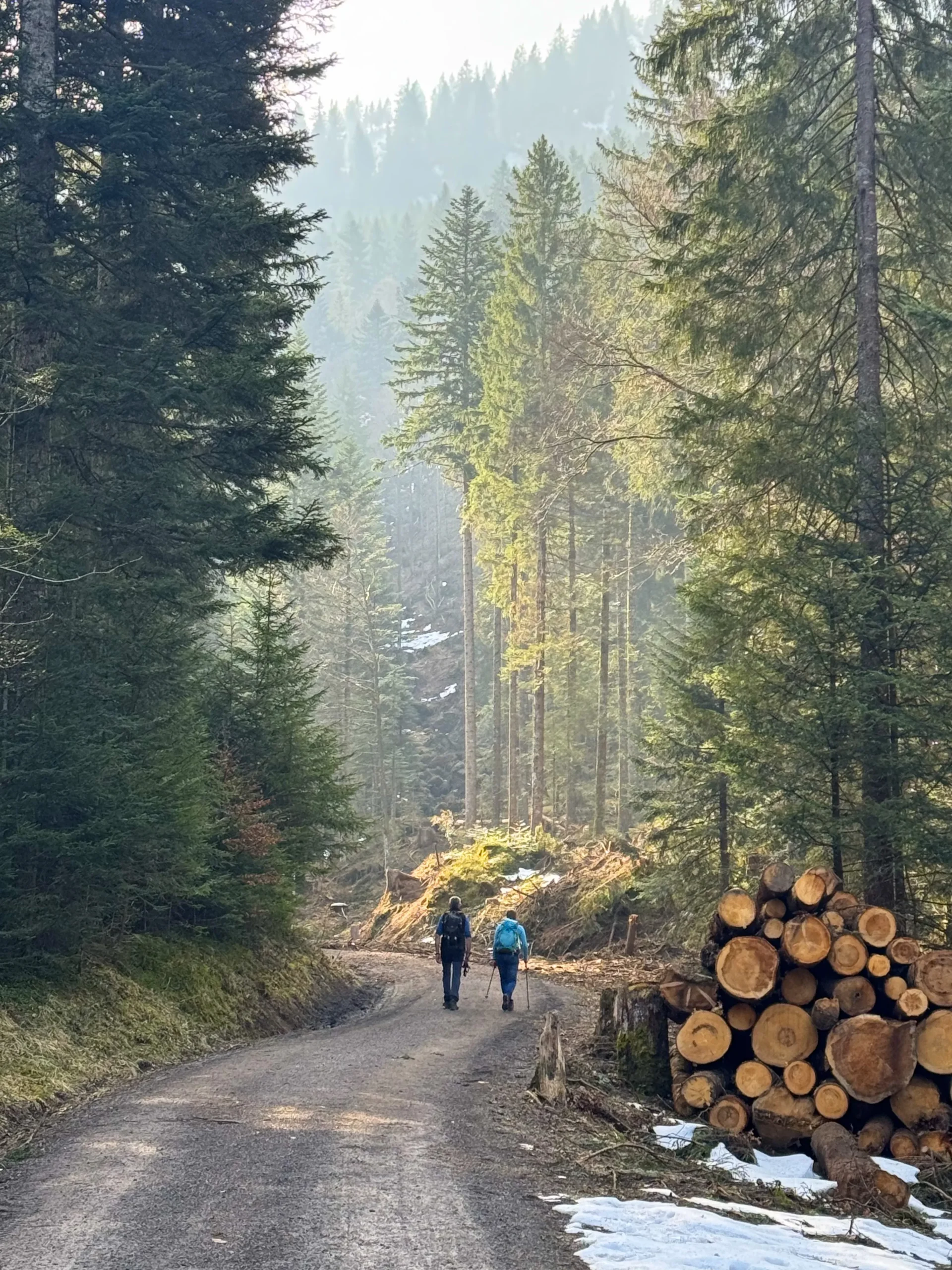
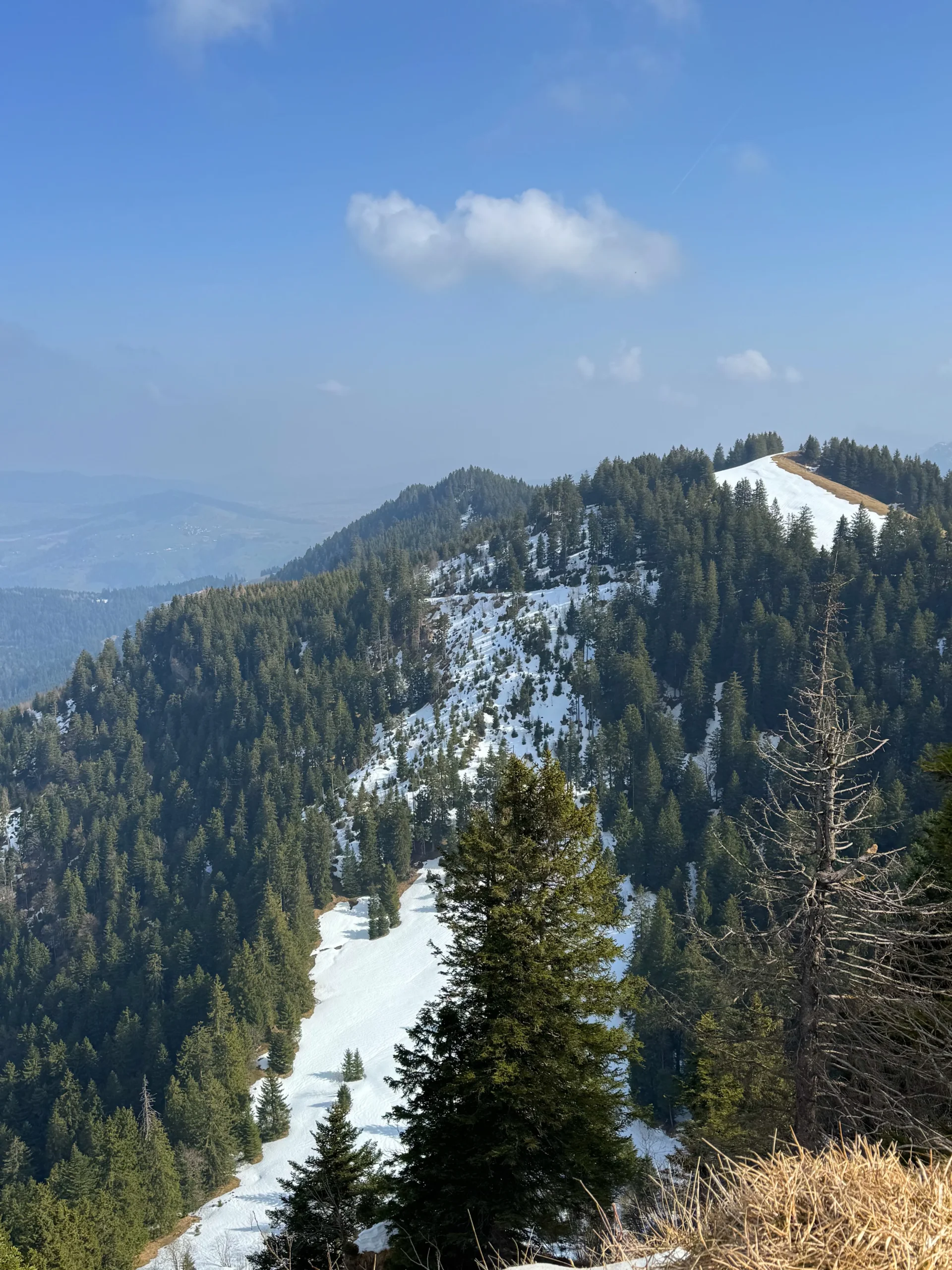
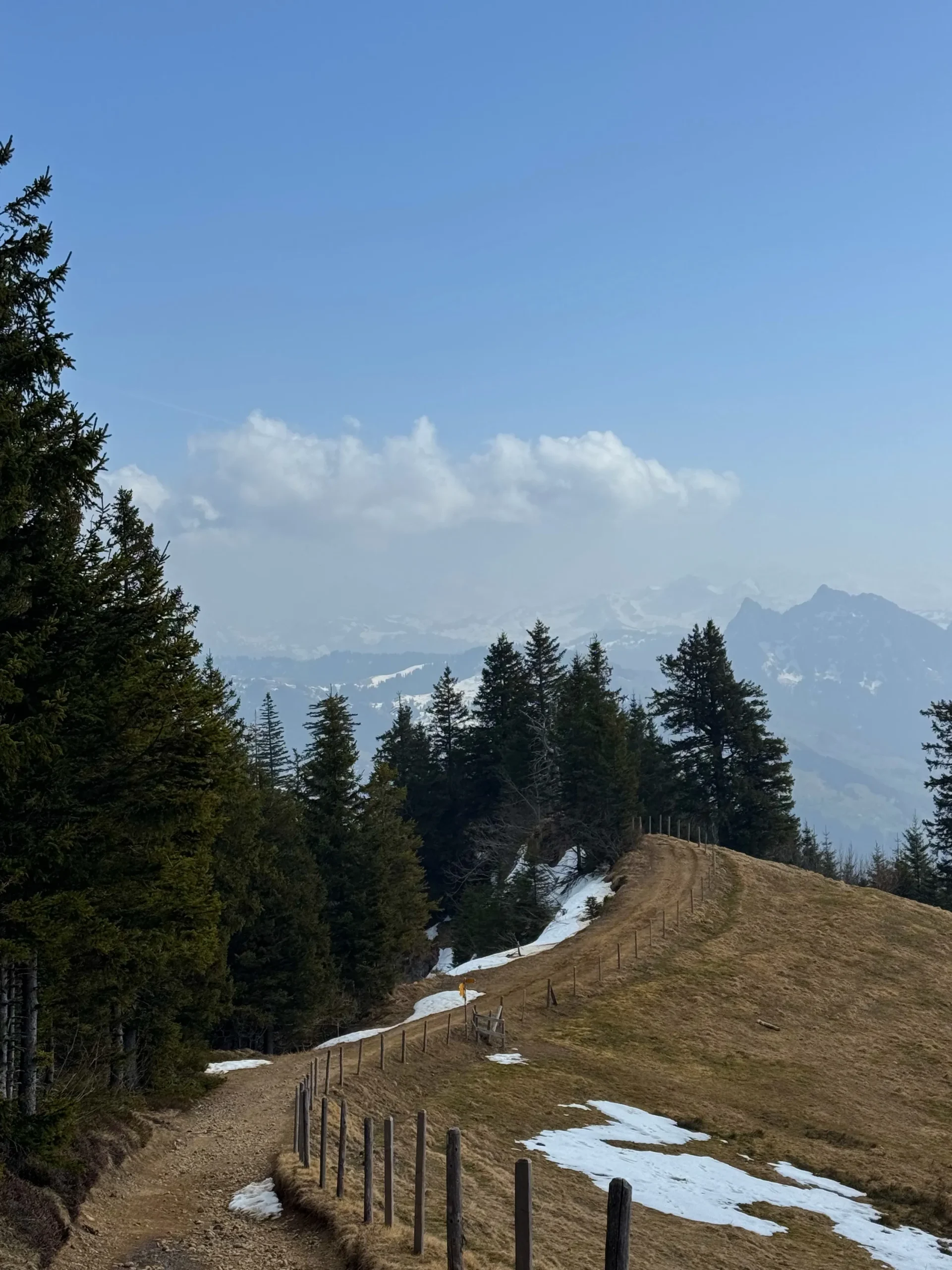
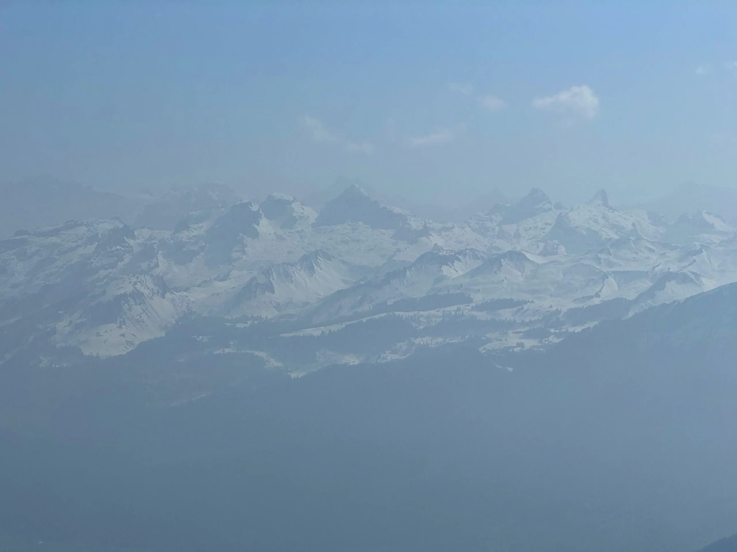
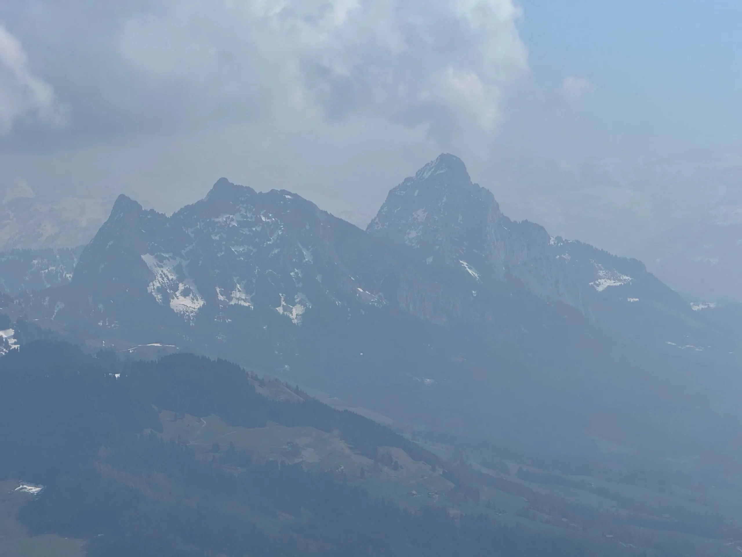
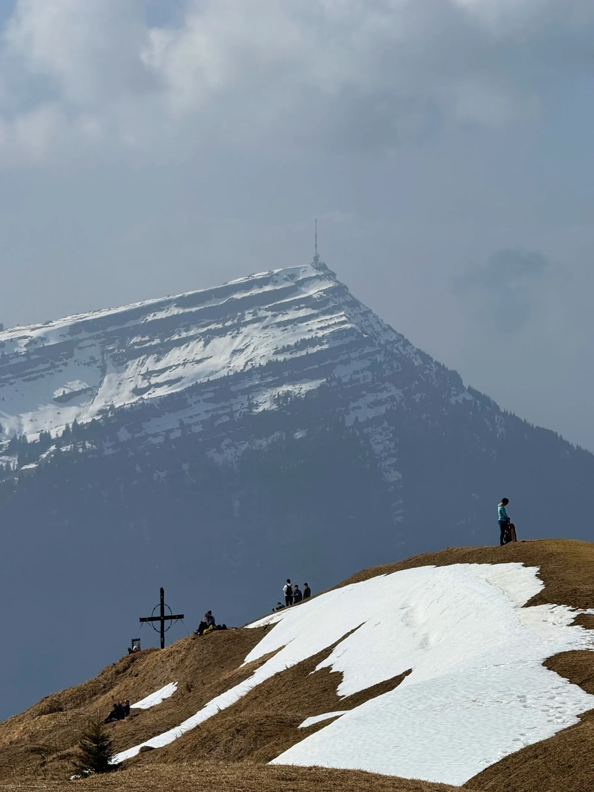
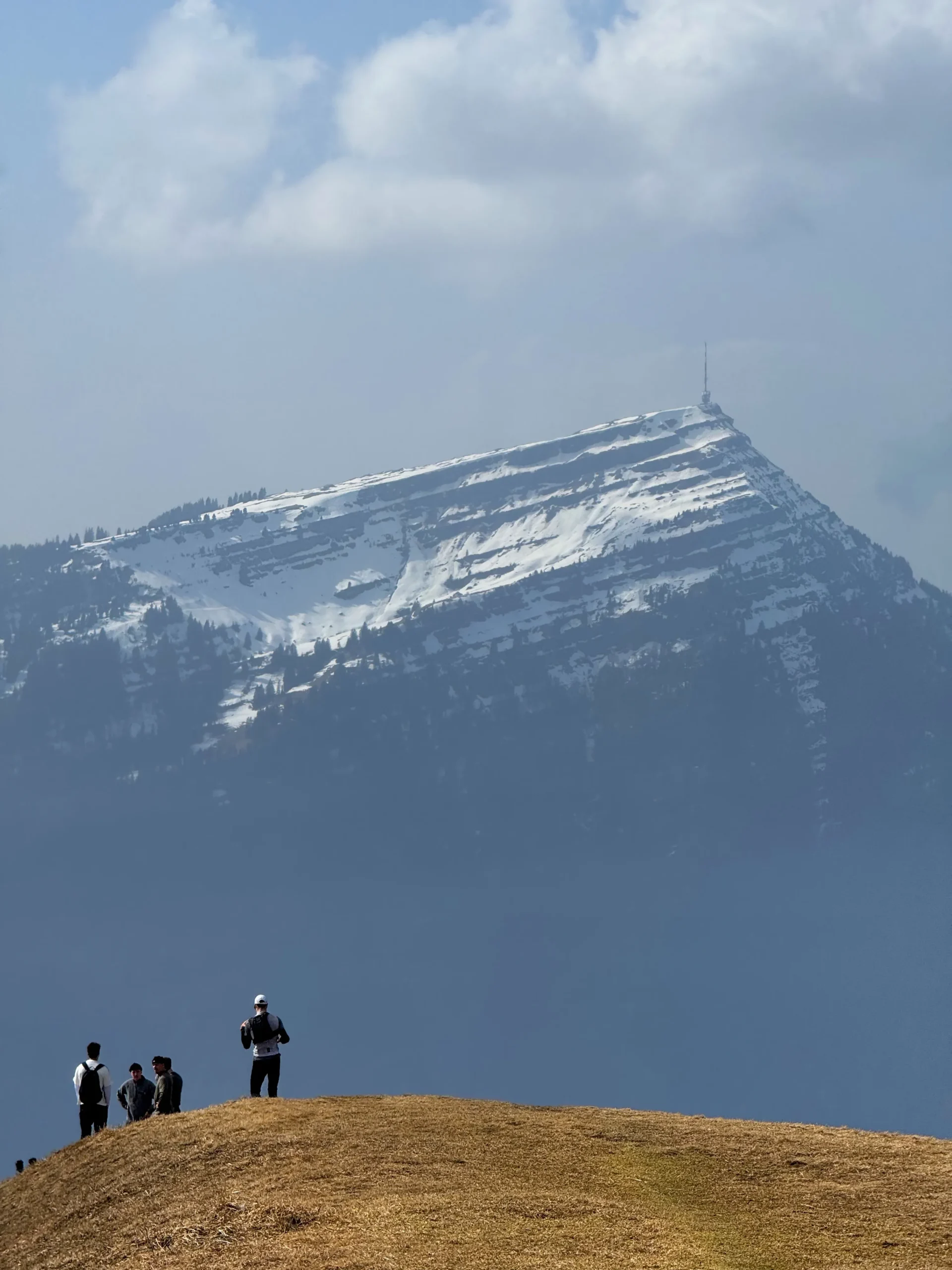
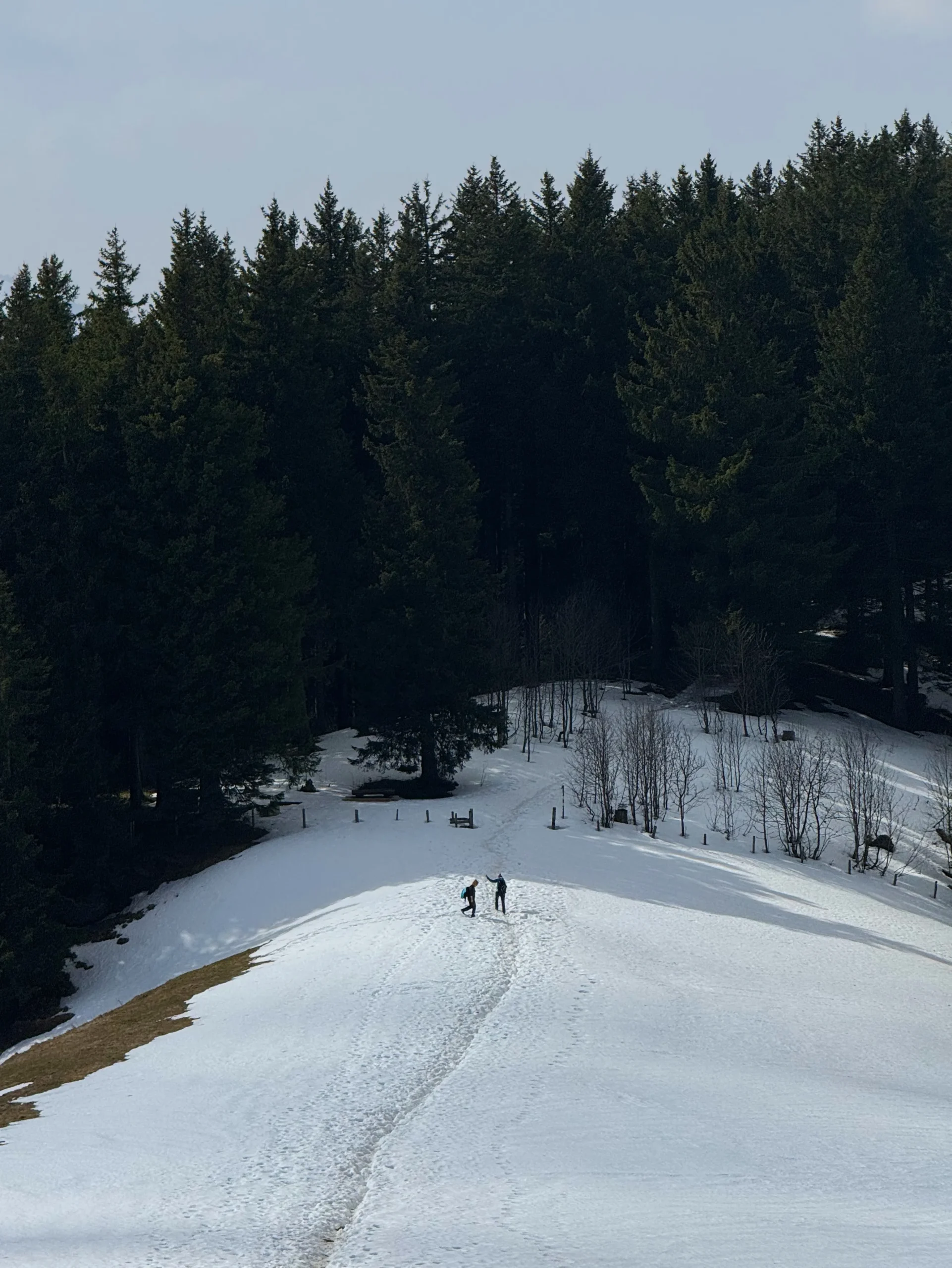
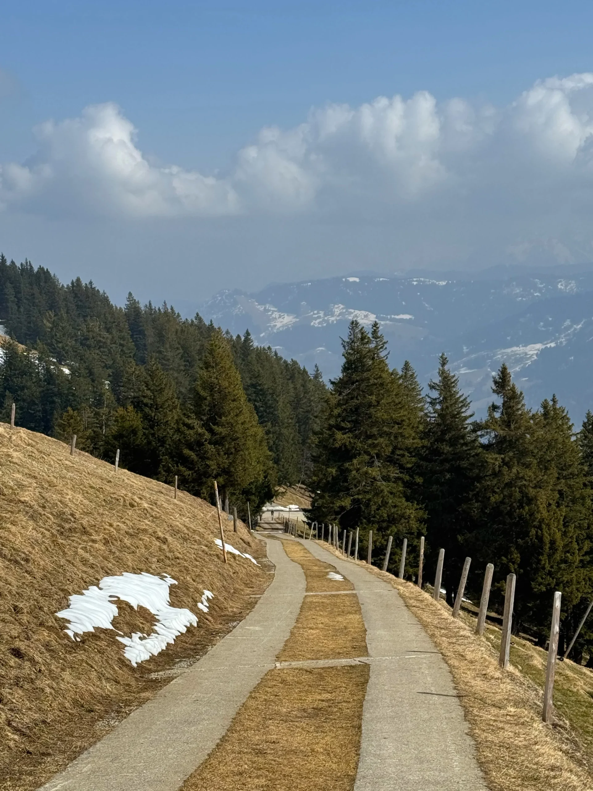
Rossberg itself does not seem particularly high compared with the great peaks of the Alps. There are no glaciers, rocky four-thousand-meter summits, or high Alpine passes here. Instead, the route has a completely different character: forest trails gradually lead to open slopes and the ridge, where the views become wider with every step. Looking down at Lake Zug and Lake Lauerz is especially beautiful, while the distinctive silhouettes of the Grosser and Kleiner Mythen are easy to recognize on the horizon. On a clear day, it feels as if an enormous map of Central Switzerland has unfolded in front of you.
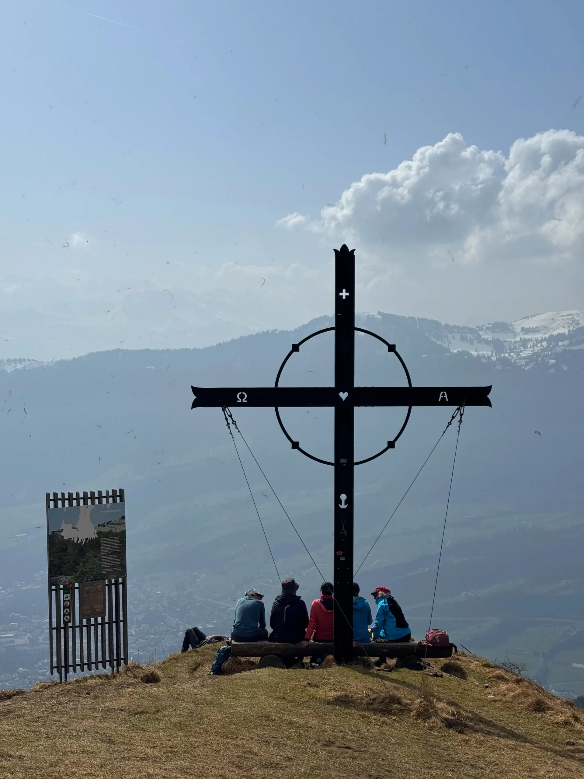
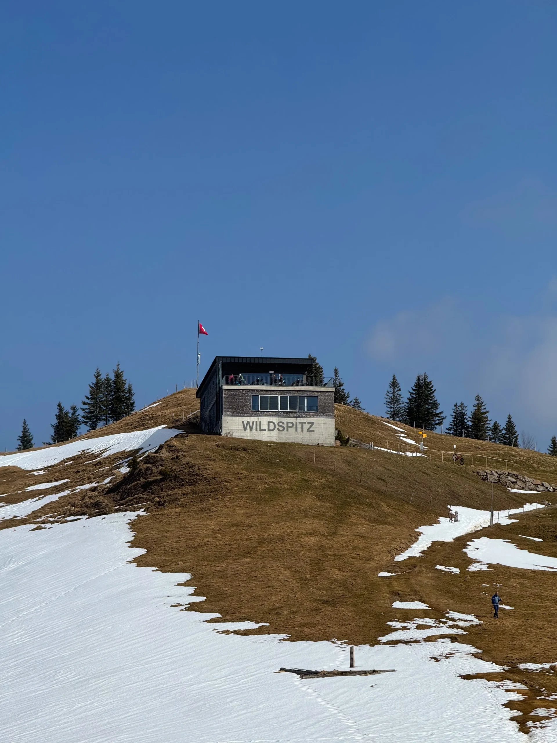
One of the main goals of our hike was Wildspitz. At 1,580 meters, it is the highest point in the entire Canton of Zug. There is no large tourist complex here and none of the crowds found on many of Switzerland’s more famous summits. That is exactly what gives Wildspitz its special atmosphere: mountains, meadows, forests, and an enormous sense of space all around you. After the climb, it feels especially rewarding simply to stop, look around, and realize how many different corners of Switzerland can be seen from almost a single spot.
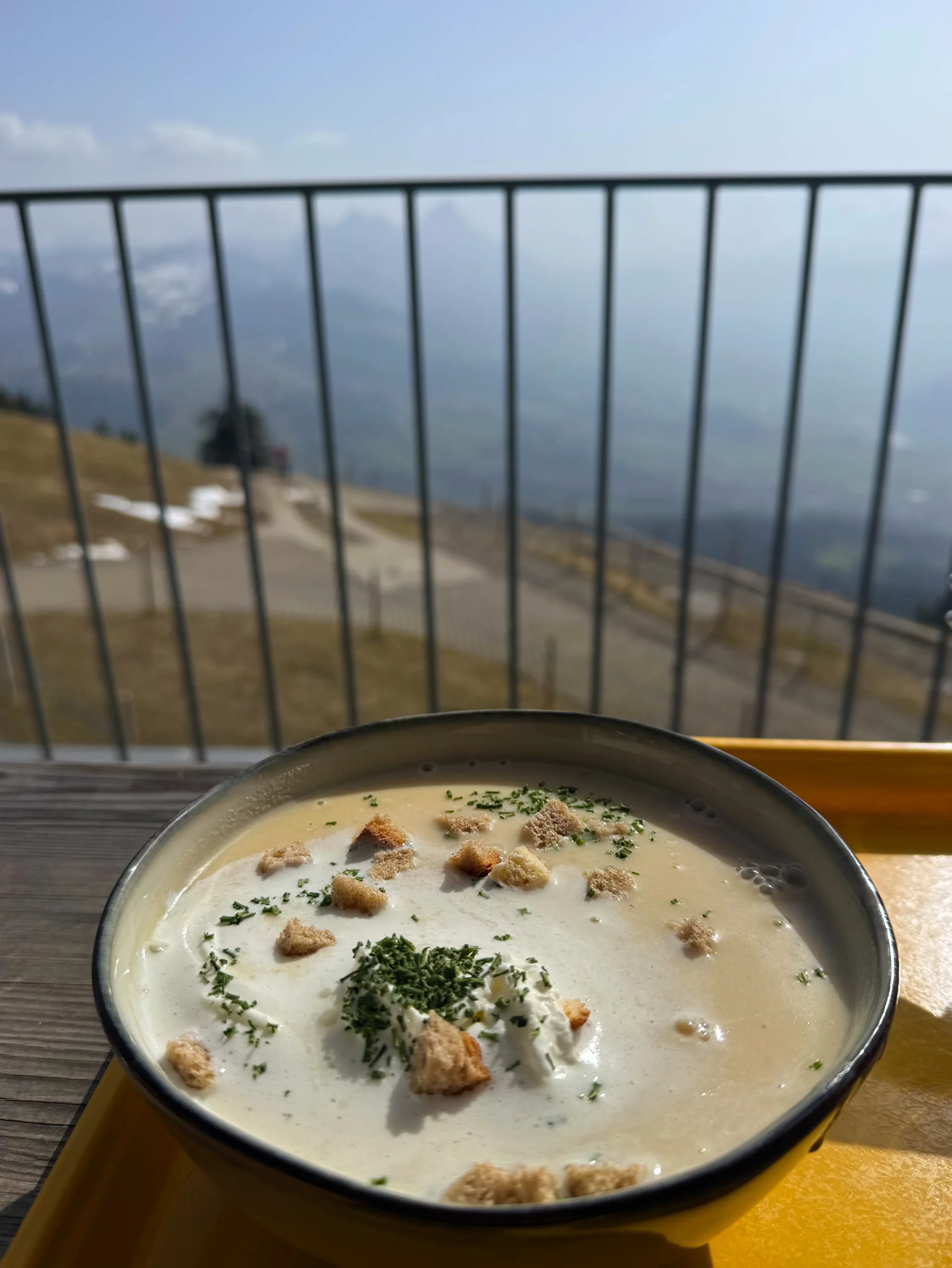
Another small but very enjoyable part of our hike was stopping at the cozy Berggasthaus Wildspitz, located right beside the summit at an altitude of almost 1,580 meters. After the long climb, being able to step inside, sit down at a wooden table, and rest for a while felt particularly welcome. We ordered a hot soup — simple mountain food that tasted unbelievably good after several hours on the trail. The guesthouse itself is wonderfully cozy and fits perfectly into its surroundings: a traditional Swiss atmosphere, warmth, silence, and mountains just outside the window. These are the kinds of stops you often do not plan in advance, yet they somehow become some of the warmest memories of a hike.
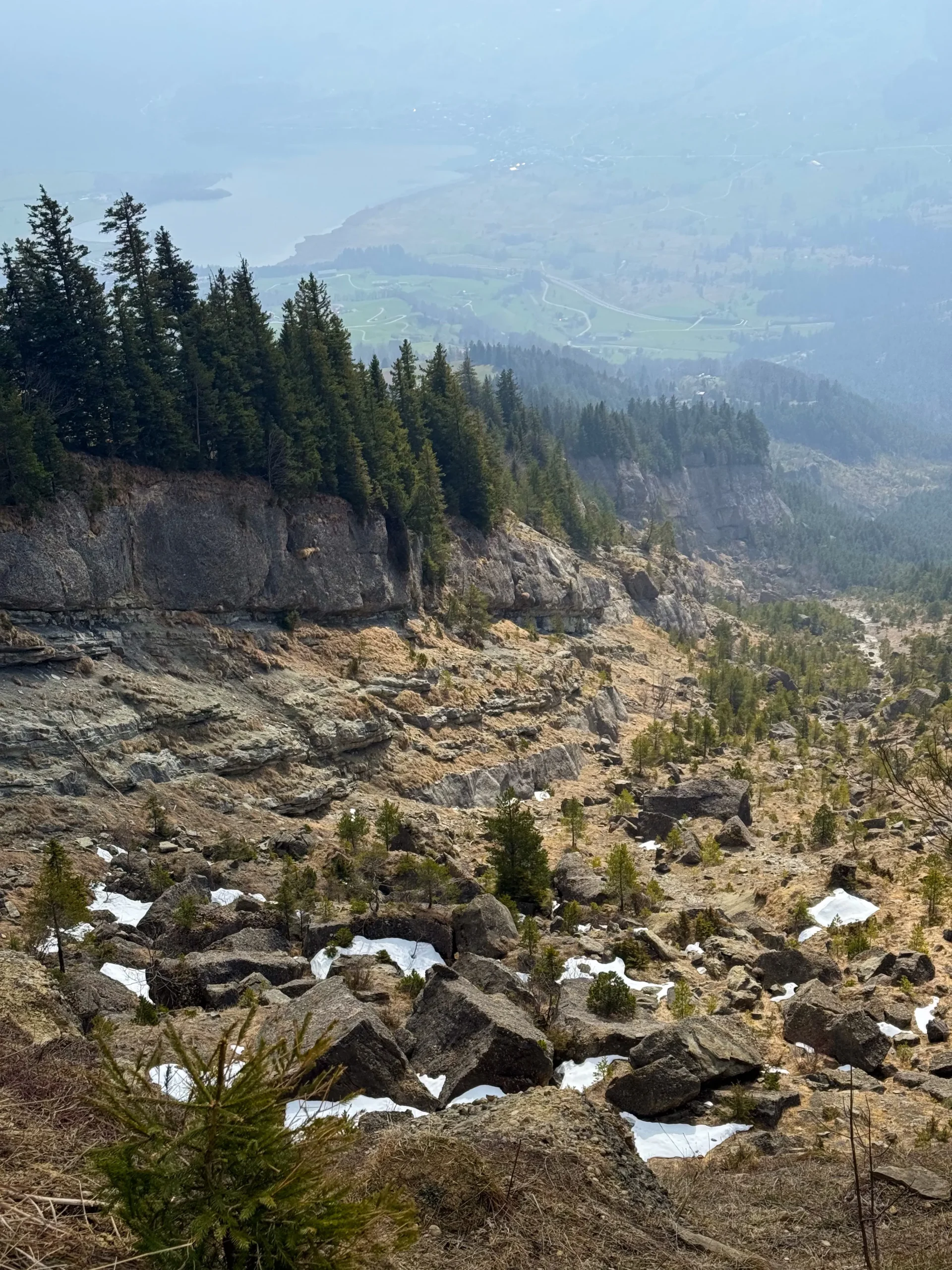
But the most unusual part of the hike was waiting for us on Gnipen, the neighboring summit of Rossberg at around 1,566 meters. From here, there is much more to see than the beautiful panorama of Goldau and Lake Lauerz. Directly below lies an enormous scar on the mountainside — the place where, on September 2, 1806, a colossal mass of rock broke away from the mountain. Today, vegetation once again covers much of the slopes, but the shape of the mountain and the landslide scar are still clearly visible. Once you know the history of this place, you begin to look at the landscape with completely different eyes.
The disaster was preceded by a long period of heavy rainfall. Water penetrated between layers of Nagelfluh conglomerate and softer marl, gradually making the slope unstable. Local residents had noticed large cracks appearing on the mountain even before the tragedy, but no one could have imagined the scale of what was about to happen. On the evening of September 2, 1806, part of the slope near Gnipen began to move. Around 40 million cubic meters of rock rushed down into the valley within just a few minutes, descending roughly one thousand meters in elevation. The consequences were devastating. The enormous mass of rock and earth buried Goldau, Röthen, and part of Buosingen, destroying houses, farms, and churches. A total of 457 people and hundreds of animals lost their lives. The debris reached Lake Lauerz and triggered a powerful wave that flooded parts of the shoreline. The enormous boulders that can still be seen around Goldau today, including those within the Natur- und Tierpark Goldau, are not simply part of the local landscape. Many of them were carried into the valley during the catastrophe of 1806.
It was this contrast that made the hike so special for us. Gnipen is peaceful today, surrounded by green slopes, forests, lakes, and mountains. Modern Arth-Goldau can be seen below, with trains passing through, houses standing in the valley, and people going about their everyday lives. Only the enormous scar in the mountainside reminds you that just over two centuries ago, the entire landscape here was transformed within a matter of minutes. It is one of those moments while traveling when a beautiful place suddenly takes on a completely different meaning once you discover its history. From Gnipen, you can continue directly along the Rossberg ridge to Wildspitz. The two summits are very close to each other, making them a natural combination for a single hike. Yet they leave completely different impressions. Gnipen stays in your memory because of its dramatic history and the direct view over the Goldau landslide area, while Wildspitz offers a wonderful sense of open space and a sweeping panorama of Central Switzerland. Together, they make this route much more fascinating than simply climbing a single mountain summit.
For us, this hike was another reminder of just how diverse Switzerland can be, even far away from its most famous high-Alpine routes. Rossberg is certainly not among the country’s highest mountains, but it has everything we love about hiking: forest trails, open ridges, panoramas of lakes and the Alps, peaceful surroundings, and the unmistakable feeling of being in the mountains. The history of Gnipen and Goldau adds another dimension to the experience. After a hike like this, you look at the familiar landscape around Arth-Goldau in a completely different way.
⛰️ ℹ️ One of the most astonishing aspects of the Goldau landslide is the speed at which everything happened. Around 40 million cubic meters of rock broke away from the slopes of Rossberg and reached the valley in only about three to four minutes. The flow was so powerful that part of the rock mass climbed approximately 100 meters up the opposite slope. What looks today like the peaceful green landscape surrounding Goldau was, in fact, shaped by a single catastrophic event.
🇨🇭 Interesting Facts about Wildspitz, Gnipen & Rossberg
The highest point in the Canton of Zug. At 1,580 meters, Wildspitz is the highest point in the canton.
Two neighboring summits. Wildspitz and Gnipen are located on the same Rossberg ridge, making it easy to combine them into a single hike.
Gnipen — 1,566 meters. It is only slightly lower than Wildspitz but has particular historical significance because of the Goldau landslide.
The disaster of 1806. On September 2, 1806, an enormous section of the southern slope of Rossberg collapsed into the valley.
40 million cubic meters. This is the estimated volume of rock that was set in motion during the catastrophe.
457 lives lost. The Goldau landslide became one of the most devastating natural disasters in Swiss history.
A wave on Lake Lauerz. The rock mass reached the lake and triggered a powerful wave that flooded parts of its shoreline.
The scars are still visible today. From the summit of Gnipen, the landslide scar that shaped the modern southern slope of Rossberg can still be clearly seen.
Goldau stands on the debris. Much of the landscape surrounding modern Goldau was formed by material carried down from the mountain during the landslide.
A panorama of Central Switzerland. From the Rossberg ridge, there are beautiful views of Lake Zug, Lake Lauerz, the Lake Ägeri region, Rigi, the Mythen, and numerous Alpine peaks.
Є гори, які запам’ятовуються передусім краєвидами, а є такі, де за красивою панорамою приховується ціла історія. Наш похід на Wildspitz став саме таким. Ця вершина заввишки 1580 метрів є найвищою точкою хребта Rossberg і водночас найвищою точкою кантону Zug. Звідси відкривається чудова панорама Центральної Швейцарії: озера, зелені пагорби, далекі альпійські вершини та знайомі містечка в долинах здаються зовсім маленькими. Але найбільше нас вразила сусідня вершина Gnipen. Стоячи там сьогодні серед тиші й неймовірної краси, важко уявити, що саме звідси понад двісті років тому почалася одна з найстрашніших природних катастроф в історії Швейцарії.
Сам Rossberg не виглядає особливо високим у порівнянні з великими альпійськими вершинами. Тут немає льодовиків, скелястих чотиритисячників чи високогірних перевалів. Натомість маршрут має зовсім інший характер: лісові стежки поступово виводять на відкриті схили та гребінь, звідки краєвиди стають дедалі ширшими. Особливо красиво дивитися вниз на Zugersee та Lauerzersee, а на горизонті легко впізнати характерні силуети Grosser і Kleiner Mythen. У гарну погоду здається, що перед тобою розгорнулася величезна карта Центральної Швейцарії.
Однією з головних цілей нашого маршруту був Wildspitz. Його висота — 1580 метрів, і це найвища точка всього кантону Zug. Тут немає великого туристичного комплексу чи натовпів, характерних для багатьох популярних швейцарських вершин. Саме тому Wildspitz має особливу атмосферу: гори, луки, ліс і величезний простір навколо. Після підйому особливо приємно просто зупинитися, подивитися навколо й усвідомити, скільки різних куточків Швейцарії можна побачити практично з одного місця.
Ще однією маленькою, але дуже приємною частиною нашого походу стала зупинка в затишному Berggasthaus Wildspitz, розташованому просто біля вершини на висоті майже 1580 метрів. Після довгого підйому можливість зайти всередину, сісти за дерев’яний стіл і трохи відпочити була особливо цінною. Ми замовили гарячий суп — просту гірську їжу, яка після кількох годин у дорозі здалася нам неймовірно смачною. Сам гостьовий будинок дуже затишний і чудово пасує цьому місцю: традиційна швейцарська атмосфера, тепло, тиша і гори просто за вікном. Такі зупинки часто не плануєш заздалегідь, але саме вони потім стають одними з найтепліших спогадів про похід.
Але найбільш незвичайна частина цього походу чекала на нас на Gnipen — сусідній вершині Rossberg заввишки близько 1566 метрів. Звідси відкривається не лише прекрасний вид на Goldau та Lauerzersee. Просто під ногами знаходиться величезний шрам на схилі гори — місце, звідки 2 вересня 1806 року зірвалася колосальна маса гірської породи. Сьогодні схили знову вкриті рослинністю, але форма гори й зона відриву все ще добре помітні. Коли знаєш історію цього місця, дивишся на пейзаж зовсім іншими очима.
Катастрофі передували тривалі сильні дощі. Вода проникала між шарами конгломерату Nagelfluh та м’якшими шарами мергелю, поступово роблячи схил нестабільним. Місцеві жителі ще до трагедії помічали на горі великі тріщини, але масштаб майбутньої катастрофи тоді неможливо було уявити. Увечері 2 вересня 1806 року частина схилу біля Gnipen прийшла в рух. Близько 40 мільйонів кубічних метрів гірської породи за лічені хвилини подолали приблизно тисячу метрів перепаду висоти й понеслися в долину. Наслідки були страшними. Потік каміння та землі поховав Goldau, Röthen і частину Buosingen, знищивши будинки, ферми та церкви. Загинули 457 людей і сотні тварин. Маса породи досягла Lauerzersee та спричинила потужну хвилю, яка затопила частину узбережжя. Величезні кам’яні брили, які сьогодні можна побачити в районі Goldau, зокрема на території Natur- und Tierpark Goldau, — це не просто частина місцевого ландшафту. Багато з них опинилися в долині саме внаслідок катастрофи 1806 року.
Саме цей контраст зробив похід для нас особливим. На Gnipen сьогодні тихо: навколо зелені схили, ліси, озера та гори. Унизу видно сучасний Arth-Goldau, проходять поїзди, стоять будинки, живуть люди. І лише величезна западина на схилі нагадує, що трохи більше двох століть тому за кілька хвилин тут повністю змінився ландшафт. Це один із тих моментів у подорожах, коли красиве місце раптом отримує зовсім інший масштаб після того, як дізнаєшся його історію. Від Gnipen до Wildspitz можна пройти просто вздовж гребеня Rossberg. Дві вершини розташовані зовсім поруч, тому їх природно об’єднати в один маршрут. І при цьому вони залишають зовсім різні враження: Gnipen запам’ятовується своєю драматичною історією та видом просто в зону Goldauer Bergsturz, тоді як Wildspitz дарує відчуття відкритого простору та широку панораму Центральної Швейцарії. Разом вони роблять цей маршрут набагато цікавішим, ніж звичайний підйом на одну вершину.
Для нас цей похід став ще одним нагадуванням про те, наскільки різною може бути Швейцарія навіть далеко від найвідоміших високогірних маршрутів. Rossberg не належить до найвищих гір країни, але тут є все, за що ми любимо походи: лісові стежки, відкриті гребені, панорами озер та Альп, тиша і відчуття справжньої гори. А історія Gnipen і Goldau додає цьому місцю ще один вимір. Після такого походу дивишся на знайомий пейзаж навколо Arth-Goldau вже зовсім інакше.
⛰️ ℹ️ Найдивовижніше в історії Goldauer Bergsturz — швидкість, з якою все сталося. Близько 40 мільйонів кубічних метрів гірської породи зірвалися зі схилу Rossberg і приблизно за три-чотири хвилини подолали шлях до долини. Потік був настільки потужним, що частина кам’яної маси піднялася приблизно на 100 метрів угору по протилежному схилу. Те, що сьогодні виглядає як спокійний зелений ландшафт навколо Goldau, фактично було сформоване однією катастрофічною подією.
🇨🇭 Цікаві факти про Wildspitz, Gnipen та Rossberg
Найвища точка кантону Zug. Wildspitz має висоту 1580 метрів і є найвищою точкою кантону.
Дві вершини поруч. Wildspitz і Gnipen розташовані на одному гребені Rossberg, тому їх легко об’єднати в один похід.
Gnipen — 1566 метрів. Він лише трохи нижчий за Wildspitz, але має особливе історичне значення через Goldauer Bergsturz.
Катастрофа 1806 року. 2 вересня 1806 року величезна частина південного схилу Rossberg зірвалася в долину.
40 мільйонів кубічних метрів. Саме таким приблизно був об’єм гірської породи, що прийшла в рух під час катастрофи.
457 загиблих. Goldauer Bergsturz став однією з найбільших природних катастроф в історії Швейцарії.
Хвиля на Lauerzersee. Кам’яна маса досягла озера й спричинила потужну хвилю, яка затопила частину його берегів.
Сліди видно й сьогодні. З вершини Gnipen чудово проглядається зона відриву породи, яка сформувала сучасний вигляд південного схилу Rossberg.
Goldau стоїть на уламках. Значна частина сучасного ландшафту навколо Goldau сформована матеріалом, принесеним вниз під час обвалу.
Панорама Центральної Швейцарії. З гребеня Rossberg відкриваються краєвиди на Zugersee, Lauerzersee, район Ägerisee, Rigi, Mythen та численні вершини Альп.
Manche Berge bleiben vor allem wegen ihrer Aussicht in Erinnerung, während sich hinter dem wunderschönen Panorama anderer Orte eine ganze Geschichte verbirgt. Unsere Wanderung auf den Wildspitz war genau so ein Erlebnis. Mit 1.580 Metern ist der Wildspitz der höchste Punkt des Rossbergs und gleichzeitig der höchste Punkt des Kantons Zug. Von hier eröffnet sich ein herrliches Panorama über die Zentralschweiz: Seen, grüne Hügel, ferne Alpengipfel und vertraute Ortschaften tief unten im Tal wirken plötzlich ganz klein. Besonders beeindruckt hat uns jedoch der benachbarte Gipfel Gnipen. Wenn man heute dort inmitten der Stille und dieser außergewöhnlichen Landschaft steht, kann man sich kaum vorstellen, dass genau hier vor mehr als zweihundert Jahren eine der verheerendsten Naturkatastrophen der Schweizer Geschichte ihren Anfang nahm.
Der Rossberg selbst wirkt im Vergleich zu den großen Gipfeln der Alpen nicht besonders hoch. Hier gibt es keine Gletscher, felsigen Viertausender oder hochalpinen Pässe. Dafür hat die Wanderung einen ganz eigenen Charakter: Waldwege führen allmählich hinauf zu offenen Hängen und auf den Bergkamm, von wo aus die Aussicht mit jedem Schritt weiter wird. Besonders schön ist der Blick hinunter auf den Zugersee und den Lauerzersee, während am Horizont die markanten Silhouetten des Grossen und Kleinen Mythen leicht zu erkennen sind. Bei klarem Wetter fühlt es sich an, als würde sich vor einem eine riesige Landkarte der Zentralschweiz ausbreiten.
Eines der Hauptziele unserer Wanderung war der Wildspitz. Mit seinen 1.580 Metern ist er der höchste Punkt des gesamten Kantons Zug. Hier gibt es weder einen großen touristischen Komplex noch die Menschenmassen, die man auf vielen bekannteren Schweizer Gipfeln findet. Genau das verleiht dem Wildspitz seine besondere Atmosphäre: Berge, Wiesen, Wälder und unglaublich viel freier Raum rundherum. Nach dem Aufstieg ist es besonders schön, einfach stehen zu bleiben, sich umzusehen und festzustellen, wie viele verschiedene Ecken der Schweiz man praktisch von einem einzigen Ort aus sehen kann.
Ein weiterer kleiner, aber besonders schöner Teil unserer Wanderung war die Pause im gemütlichen Berggasthaus Wildspitz, das direkt beim Gipfel auf fast 1.580 Metern Höhe liegt. Nach dem langen Aufstieg war es besonders angenehm, hineinzugehen, sich an einen Holztisch zu setzen und eine Weile auszuruhen. Wir bestellten eine heiße Suppe – ein einfaches Berggericht, das nach mehreren Stunden unterwegs unglaublich gut schmeckte. Auch das Gasthaus selbst ist wunderbar gemütlich und passt perfekt zu diesem Ort: traditionelle Schweizer Atmosphäre, Wärme, Ruhe und die Berge direkt vor dem Fenster. Solche Pausen plant man oft nicht im Voraus, und doch werden gerade sie später zu einigen der schönsten Erinnerungen an eine Wanderung.
Der aussergewöhnlichste Teil unserer Wanderung erwartete uns jedoch auf dem Gnipen, dem benachbarten Gipfel des Rossbergs auf rund 1.566 Metern Höhe. Von hier aus sieht man nicht nur das wunderschöne Panorama von Goldau und dem Lauerzersee. Direkt unterhalb des Gipfels liegt eine riesige Narbe im Berghang – genau dort löste sich am 2. September 1806 eine gewaltige Gesteinsmasse vom Berg. Heute sind die Hänge wieder größtenteils von Vegetation bedeckt, doch die Form des Berges und das Abbruchgebiet sind noch immer deutlich zu erkennen. Sobald man die Geschichte dieses Ortes kennt, betrachtet man die Landschaft mit völlig anderen Augen.
Der Katastrophe war eine längere Periode mit starken Regenfällen vorausgegangen. Wasser drang zwischen die Schichten des Nagelfluh-Konglomerats und die weicheren Mergelschichten ein und machte den Hang zunehmend instabil. Schon vor der Katastrophe hatten die Bewohner der Umgebung große Risse am Berg bemerkt, doch das Ausmass dessen, was folgen sollte, konnte damals niemand erahnen. Am Abend des 2. September 1806 setzte sich ein Teil des Hangs beim Gnipen in Bewegung. Rund 40 Millionen Kubikmeter Gestein stürzten innerhalb weniger Minuten ins Tal und überwanden dabei einen Höhenunterschied von ungefähr tausend Metern. Die Folgen waren verheerend. Die gewaltige Masse aus Gestein und Erde begrub Goldau, Röthen und einen Teil von Buosingen und zerstörte Häuser, Bauernhöfe und Kirchen. 457 Menschen und Hunderte Tiere verloren ihr Leben. Die Gesteinsmassen erreichten den Lauerzersee und lösten eine mächtige Welle aus, die Teile des Ufers überschwemmte. Die riesigen Felsblöcke, die man heute noch rund um Goldau sehen kann, unter anderem auf dem Gelände des Natur- und Tierparks Goldau, sind nicht einfach nur Teil der örtlichen Landschaft. Viele von ihnen gelangten während der Katastrophe von 1806 ins Tal.
Gerade dieser Kontrast machte die Wanderung für uns so besonders. Heute ist es auf dem Gnipen ruhig: Rundherum liegen grüne Hänge, Wälder, Seen und Berge. Tief unten sieht man das moderne Arth-Goldau, Züge fahren vorbei, Häuser stehen im Tal und die Menschen gehen ihrem Alltag nach. Nur die riesige Narbe im Berghang erinnert daran, dass sich hier vor etwas mehr als zwei Jahrhunderten die gesamte Landschaft innerhalb weniger Minuten verändert hat. Es ist einer dieser Momente auf Reisen, in denen ein schöner Ort plötzlich eine ganz andere Bedeutung bekommt, sobald man seine Geschichte kennt. Vom Gnipen kann man direkt über den Kamm des Rossbergs zum Wildspitz weiterwandern. Die beiden Gipfel liegen sehr nahe beieinander und lassen sich deshalb wunderbar zu einer einzigen Wanderung verbinden. Trotzdem hinterlassen sie ganz unterschiedliche Eindrücke. Der Gnipen bleibt wegen seiner dramatischen Geschichte und des direkten Blicks auf das Gebiet des Goldauer Bergsturzes in Erinnerung, während der Wildspitz ein wunderbares Gefühl von Weite und ein beeindruckendes Panorama über die Zentralschweiz bietet. Zusammen machen sie diese Route viel interessanter als den einfachen Aufstieg auf nur einen Gipfel.
Für uns war diese Wanderung eine weitere Erinnerung daran, wie vielfältig die Schweiz auch abseits ihrer berühmtesten hochalpinen Routen sein kann. Der Rossberg gehört sicherlich nicht zu den höchsten Bergen des Landes, bietet aber alles, was wir am Wandern lieben: Waldwege, offene Bergkämme, Panoramen über Seen und Alpen, Ruhe und dieses unverwechselbare Gefühl, wirklich in den Bergen zu sein. Die Geschichte von Gnipen und Goldau verleiht diesem Ort eine zusätzliche Dimension. Nach einer solchen Wanderung betrachtet man selbst die vertraute Landschaft rund um Arth-Goldau mit völlig anderen Augen.
⛰️ ℹ️ Einer der erstaunlichsten Aspekte des Goldauer Bergsturzes ist die Geschwindigkeit, mit der alles geschah. Rund 40 Millionen Kubikmeter Gestein lösten sich vom Hang des Rossbergs und erreichten das Tal innerhalb von nur etwa drei bis vier Minuten. Die Bewegung war so gewaltig, dass ein Teil der Gesteinsmasse am gegenüberliegenden Hang etwa 100 Meter wieder hinaufgeschoben wurde. Was heute wie eine friedliche grüne Landschaft rund um Goldau aussieht, wurde tatsächlich durch ein einziges katastrophales Ereignis geprägt.
🇨🇭 Interessante Fakten über Wildspitz, Gnipen & Rossberg
Der höchste Punkt des Kantons Zug. Mit 1.580 Metern ist der Wildspitz der höchste Punkt des Kantons.
Zwei benachbarte Gipfel. Wildspitz und Gnipen liegen auf demselben Kamm des Rossbergs und lassen sich deshalb problemlos zu einer einzigen Wanderung verbinden.
Gnipen – 1.566 Meter. Er ist nur wenig niedriger als der Wildspitz, besitzt wegen des Goldauer Bergsturzes jedoch eine besondere historische Bedeutung.
Die Katastrophe von 1806. Am 2. September 1806 stürzte ein gewaltiger Teil des südlichen Hangs des Rossbergs ins Tal.
40 Millionen Kubikmeter. So groß war schätzungsweise das Volumen der Gesteinsmasse, die sich während der Katastrophe in Bewegung setzte.
457 Todesopfer. Der Goldauer Bergsturz wurde zu einer der verheerendsten Naturkatastrophen in der Geschichte der Schweiz.
Eine Welle im Lauerzersee. Die Gesteinsmassen erreichten den See und lösten eine mächtige Welle aus, die Teile des Ufers überschwemmte.
Die Spuren sind bis heute sichtbar. Vom Gipfel des Gnipen ist das Abbruchgebiet, das die heutige Form des südlichen Rossberg-Hangs geprägt hat, noch immer deutlich zu erkennen.
Goldau steht auf den Trümmern. Ein großer Teil der heutigen Landschaft rund um Goldau wurde durch das Material geformt, das beim Bergsturz ins Tal gelangte.
Panorama der Zentralschweiz. Vom Kamm des Rossbergs eröffnet sich eine wunderschöne Aussicht auf den Zugersee, den Lauerzersee, die Region Ägerisee, die Rigi, die Mythen und zahlreiche Gipfel der Alpen.
A beautiful little wooden chapel, donated by Josef Rickenbacher, a teacher from Steinen. On the way to Wildspitz, the highest mountain in the Canton of Zug, several benches invite you to take a short break and enjoy the surrounding nature.
 ©Every Mile Story
 ©Every Mile Story
 ©Every Mile Story
 ©Every Mile Story
 ©Every Mile Story
 ©Every Mile Story
 ©Every Mile Story
 ©Every Mile Story
 ©Every Mile Story
 ©Every Mile Story
 ©Every Mile Story
 ©Every Mile Story
 ©Every Mile Story
 ©Every Mile Story
 ©Every Mile Story
 ©Every Mile Story
 ©Every Mile Story
 ©Every Mile Story
 ©Every Mile Story
 ©Every Mile Story
 ©Every Mile Story